

The Jubilee Walkway was set up in 1977 to celebrate the Queen's Silver Jubilee. It is based round central London passing many of the capital's well known buildings
Yesterday I had another trip up to London to do Jubilee Walkway sections 2 and 3. Weather forecast was for light rain early afternoon, as it happened it was somewhat heavier but I survived. Much of this route was on familiar ground but there were a few new bits and a few surprises.
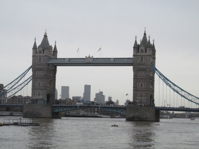
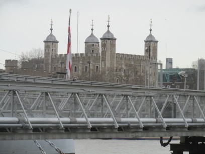
First, starting at London Bridge station, I walked along the south bank to Tower Bridge and the Tower of London. Busy as usual with all the tourists. Very familiar ground. Crossing Tower Bridge took me to more interesting places.
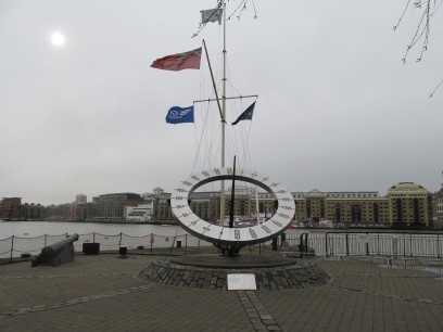
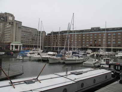
First I passed a sculpture of Girl with Dolphin with a fountain, some artist's creation. Then this very large sundial with its time marked by numbers of dots. The sun was barely peeping through so couldn't see it working. Then turned away from the Thames into St Katherine docks. These were built on the site of the 13th century St Katherine's by the Tower hospital by Thomas Telford, who is remembered by the Telford Bridge footbridge I crossed and a plaque. Nowadays there are lots of shops and restaurants along the waterfront and it is quite a nice area.
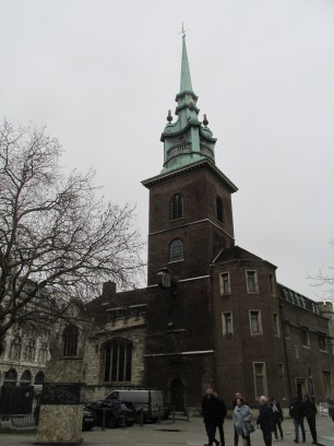
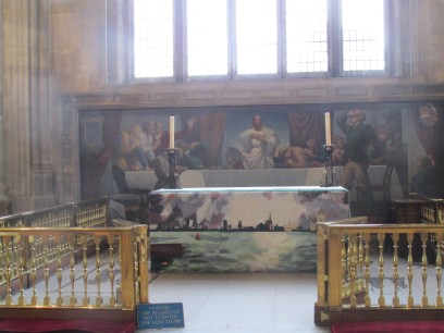
From St Katherine docks the path turns to follow the back of the Tower of London, a path I last followed with large crowds in 2014 to view the commemorative poppies. Then into the City of London and first off All Hallows-by-the-Tower, founded in AD675 and the oldest church in the City but extensively rebuilt after the Great Fire of London and WW2 damage. I popped inside for a quick look. Behind the altar is a mural of the Last Supper and there is not normally a cross on the altar as it would obscure the face of Jesus.
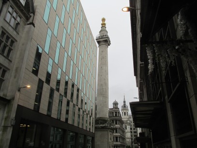
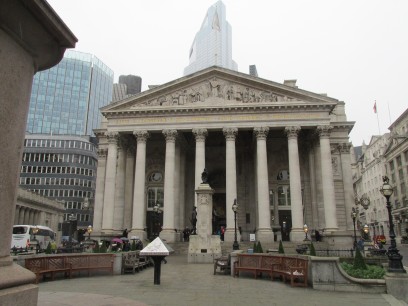
Then into the heart of the City. The Monument tower, near the tube station of that name, was built in 1677 to commemorate the Great Fire of London. The top is accessible via 311 steps but there was a long queue and a £5 charge so I didn't bother. Another small diversion to visit the Royal Exchange, traditionally used for Royal declarations but today is offices and restaurants. Time was pressing on so I didn't look inside.
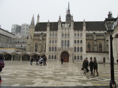
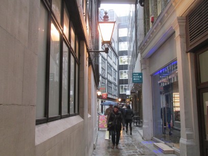
At this point I diverted from section 2 onto section 3. Directions slightly confusing but worked out where I needed to go. But the rain was beginning in earnest so it became less enjoyable. Further into the city I reached the Guildhall, formerly the administrative centre for the City of London but nowadays although still used for administrative functions is occasionally open to the public. Built in 1440 it seems to have survived with relatively minor damage in the Great Fire and wars. Then through a quaint narrow alley which London seems to have in some places.
At this point the day didn't work out as planned. The route should have taken me via an elevated walkway above the Barbican Centre complex. But there was extensive building work going on around Moorgate station and lots of places were boarded up including what was probably the entrance ramp to this overhead walkway. I managed to follow the equivalent path on the roads around there, very unattractive, and found myself entering the Barbican itself. Those of you who know the Barbican will know it has loads of staircases between floors, I couldn't find a way to the exit the other side where the walkway would have taken me (or instructions how to get to said walkway) so after eyeing up the cafe which had not much food on offer exited the way I had entered and followed the roads round to the Museum of London. The rain had eased somewhat, and the route went down to St Paul's where I rejoined section 2 (and section 1).
Another misreading of the instructions and I ended up crossing the river via Blackfriar's Bridge rather than the Millennium Bridge - I had never walked across Blackfriar's so guess that was something new... Then downstream again towards London Bridge to the Anchor inn I had earmarked for lunch which was excellent. After lunch back along the South Bank to Waterloo and the train home. A pleasant and quite tiring day out.
Looking into the Barbican elevated walkway I couldn't find. What I should have found
was the new bit of the walkway, opened in 2018:
https://diamondgeezer.blogspot.com/2018/03/st-alpheges-highwalk.html
https://www.ianvisits.co.uk/blog/2018/04/02/londons-pedways-are-back-and-theyre-magnificent/
But as I have noted in the past TFL now have largely lost interest in their walks and not updated the literature for many years. So although the original, old and unattractive, walkways round the Barbican are still there the access to them from Fore Street Avenue which it points you to was closed in 2013 when the development work for Crossrail at Moorgate was started.
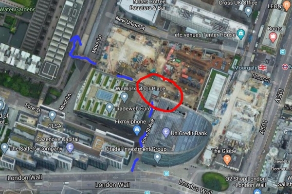
Google Satellite, conveniently updated in 2020, shows what I was faced with. The blue dotted line shows the route TFL told me to take - along Fore Street Ave then when it turns right (or should do, that bit has gone) go up a ramp to the elevated walkway. As you can see in the red circle it is now a building site and the walkway there is no more (you can see the blocked off remaining bit of it above Moor Lane.
The new section can be accessed from several places near the Guildhall. If only I had known. It is time TFL updated their literature which is becoming more and more out of date as time goes on.